Last Amazon price update was: September 13, 2024 22:57
×
Product prices and availability are accurate as of the date/time indicated and are subject to change. Any price and availability information displayed on Amazon.com (Amazon.in, Amazon.co.uk, Amazon.de, etc) at the time of purchase will apply to the purchase of this product.
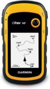
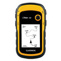
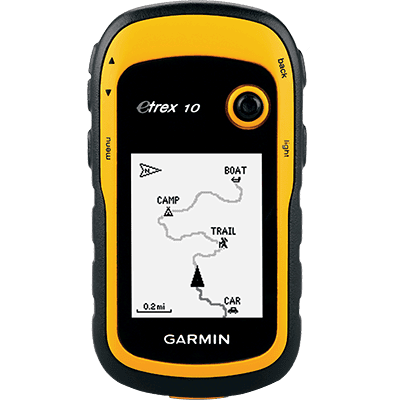
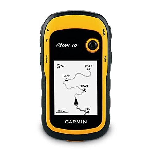
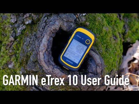
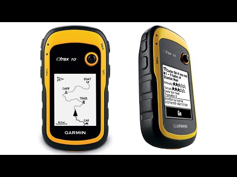
Rugged handheld navigator with preloaded worldwide basemap and 2.2 inch monochrome display
WAAS enabled GPS receiver with HotFix and GLONASS support for fast positioning and a reliable signal
Waterproof to IPX7 standards for protection against splashes, rain, etc.
Support for paperless geocaching and Garmin spine mounting accessories. Power with two AA batteries for up to 20 hours of use (best with Polaroid AA batteries)
See high and low elevation points or store waypoints along a track (start, finish and high/low altitude) to estimate time and distance between points
8 reviews for Garmin eTrex 10 Worldwide Handheld GPS Navigator
4.9out of 5
★★★★★
★★★★★
7
★★★★★
1
★★★★★
0
★★★★★
0
★★★★★
0
Write a review
Show allMost HelpfulHighest RatingLowest Rating
★★★★★
dhillier38 –
Desperate for an inexpensive GPS unit, I bought this late in 2014. At first, its logic took some getting used to, for the track record is always on, and you have to clear the active track to start a new one. Not a big deal, because of course you can save the track before deleting it. Also, the “back” button seems to be the simplest way to move through menus. This unit replaced a series of an older inexpensive Garmin model, which lived up to their reputation of failing every two years or so, though they were fine up to the failure point. Anyway, after almost four years of extensive use and the occasional drop, my eTrex 10 is still getting the job done really well. The display is old-style plain, not for everyone, but this translates into superb battery life. I can run it all day on a fresh pair of rechargeable AA’s without any fear of data loss. The accuracy of handheld GPS units is hard to pin down–smoke and mirrors, but this one certainly does the job for road logs and hiking records. Sensitivity is excellent and it doesn’t take long to find satellites. Downloading tracks is easy and dependable, something I can’t say for my old Garmin Forerunner 305 wrist GPS. When connected to a USB port, the eTrex 10’s track and waypoint data appear in a virtual drive folder, for easy copy or upload to GPS software. All I want from a GPS device is reliable information on where I am and where I’ve been, for I depend on mapping software to deliver actual graphics. Users who want better mapping support from the unit itself would find the eTrex graphics too limited. Also, I don’t go after geocaches and can’t evaluate the unit for that. But the eTrex 10 is just fine for locating myself in trackless woods, for providing a work record of where I’ve been, and for keeping track of my auto travel details. I did have one tense moment when, for failture of housekeeping, the track memory became so full that there didn’t seem to be enough left to run the track deletion sequence. Can’t remember how I got around that; maybe by starting with the smallest tracks. Didn’t want to do a complete reset because there was some information I had not downloaded.
Helpful(0)Unhelpful(0)You have already voted this
★★★★★
TREEMONKEY –
I bought this to replace my still currently missing Garmin Vista HCX. What I love is how in addition to the high sensitivity receiver my HCX had we now have the addition of Russian satellites (Glonass) to further help our coverage and boy does it help. I took this little fella on a short walk in my NY suburb and even though it is super cloudy today (zero blue sky) I was able to get over 10 satellites locked onto me and my location was pinpointed in 40 seconds from a cold start (meaning I just turned the unit on). The controls are simple, I love the little stick on this as it allows you to work the gadget while having gloves on, the system is fairly basic but that is ok, this is perfect for hiking or trying to get back to home base or a camp in the woods. The only downside I really see to this is the limited memory, I think for 2016 its inexcusable to have 8mb internal storage, you can easily allow a microsd card to be put into this for this price. I didn’t want an etrex 20 or 30 because what is great about the etrex 10 is because its display is so limited and basic it saves a ton of battery power. When i’m trying to get my butt home, I dont need beautiful vivid colors, I need point A, point B and accuracy and reliability, that is it. It would be nice to have the memory upgrade but I still feel I can work without it.
Overall this is your bare bones GPS and even on a super cloudy day like today I was getting an accuracy of 5 feet surrounded by buildings, trees, and a ton of clouds.
my main gripes with this is, again, limited memory storage (at least allow microsd card come on) and doesn’t come with a small travel case and not even a lanyard (really? you couldn’t pony up 25 cents for a lanyard garmin?)
but despite missing the bells and whistles I have to say the accuracy and reception on this thing is freaking awesome, I will soon go out on a big hiking trip to test this even further.
Helpful(0)Unhelpful(0)You have already voted this
★★★★★
chirag vora –
Great
Helpful(0)Unhelpful(0)You have already voted this
★★★★★
Ellenfonsek –
El Garmin eTrex es el navegador más básico de bolsillo para senderismo y montañismo de la marca Garmin. Desde mi punto de vista es el único equipo que necesito para explorar en conjunto con un mapa impreso y una brujula. Existen modelos mas avanzados de GARMIN que incorporan brújula digital, pantalla a color, mapas topográficos integrados, barómetro, sin embargo considero son mera vanidad ya que muchos de ellos no son 100% útiles en campo dado que existen limitaciones como: Pantalla a color: Consume la batería mas rápidamente. Brújula digital: Consume batería mas rápidamente, no te permite apuntar con precision a tu destino como lo harías con una buena brujula con espejo y no te permite ver a través del mapa para alienar tu mapa como lo harías con la brujula de placa. Barómetro: Consume batería rápidamente, muy difícilmente vas a saber tu altitud mediante el barómetro si no lo calibras en base a una altitud de referencia conocida que obviamente te lo dará un mapa impreso, para predecir el clima tendrías que estar cuidando el gps cuando de señales de cambio de presión para poder ver si hay mal tiempo próximo, lo cual implica encender el equipo y gastar mas bateria. Mapas topográficos: No es lo mismo ver un mapa en grande donde puedes ver en una sola hoja varias referencias como las montañas, en el gps sera muy difícil ver el TODO en una pantalla tan pequeña, no podrás trazar tu ruta sobre los mapas digitales tan fácilmente a menos que sea touch.
En resumen: Es el equipo ideal que tendrías que tener para uso en emergencias o cuando necesites confirmar tu ubicación, y por tanto no sustituye al uso de brujula y mapa, si no todo lo contrario, los complementan. En amazon puedes encontrarte unas buenas brújulas Suunto y Brunton a buen precio, te recomiendo uses brujula con espejo y los mapas son gratuitos en el portal del INEGI del gobierno. Su precisión es muy buena en comparación a la de un GPS de un iPhone, este último batalla mucho cuando recorres bosques densos, cosa que con el garmin no se aprecia tanto. La capacidad de ubicar (HotFix) rápidamente tu ubicación es agradecida cuando recorres cañones, barrancas o bosques densos, ya que permite mantenerte en el rumbo preciso. Puedes conectarlo a plataforma de gestión de datos propia de GARMIN mediante cable USB o hacer uso de plataformas como Wikiloc para poder bajar y subir rutas a tu GPS (Ojo con aquellas tomadas con teléfonos).
Helpful(0)Unhelpful(0)You have already voted this
★★★★★
dhillier38 –
Easy to use. Simple instructions. Highly recommend. You definitely get great quality at a good price
Helpful(0)Unhelpful(0)You have already voted this
★★★★★
Marcel F Dion –
Estaba buscando un GPS básico para Geocaching y poder ir a andar y/o en bici de vez en cuando. Estoy muy contento ya que cumple de sobra con su cometido. Lo uso con Linux y es genial para cargar y crear GPX tanto de puntos como para rutas que pre-cargo desde varias webs de senderismo.
Gasta muy poca batería y las primeras impresiones sobre él son increíbles. Muy recomendado.
Helpful(0)Unhelpful(0)You have already voted this
★★★★★
Vic Sage –
very good product
Helpful(0)Unhelpful(0)You have already voted this
★★★★★
R&T Industrial Design Associates –
Solid little gps, does exactly what it’s suppose to do. This is my 4th Garmin gps in the last 22 years and the best yet. Very fast to acquire the satellites even in the house under a tin roof. My other older gps and my 2 year old car gps won’t acquire the satellites unless I go outside. I did have to go outside the first time I turned it on but worked in the house every time after that. Garmin’s basic functions hasn’t changed much since 1995. There are a lot of switching pages depending on what you want to see but so did all the others I owned. This is a small screen gps and not a big screen tv so it’s impossible to put all the info on one page. The trick is to play with it and learn it’s as much as possible. My only major complaint is the instruction manual, it sucks big time. I give it 1 star for manual. I would say it’s impossible for a first time user to learns anything useful about the gps, Garmin sure has gone downhill when it comes to instruction manuals. Thanks to the Internet, there is a useful solution for this. YouTube contains all kind of useful instruction video for this model, enough to get you going out and use it with confidence. A major complaint I have seen in the reviews is “battery life”, most people find it is too short on two AA batteries. All my older models (3) took 4 AA and the battery life wasn’t that much longer than this unit. The big difference 2 batteries make is the size of the unit. Take my older model Garmin 12XL. Used 4 batteries and the unit was at 30% bigger but the screen is only about 5% bigger. I used to change my batteries every day before heading into the bush. I recommend you also order from Amazon a pack of ENELOOP batteries made by Panasonic. You get 4 rechargeable batteries that contains 2100 mah (stored power). 2 batteries runs the unit for a solid 24 hours,(first thing I tested), you bring the other two for spares. Never leave home without spare batteries regardless the type you use. No downloadable maps is another complaint I read often, if you want topo maps on your gps, do not order this unit, go for the etrex 20. I did see some videos on YouTube that shows how to download some maps on the unit but I found the quality of the maps were not worth it. I always carry a good quality map and a compass with me, gps or not. Much easier to plot a course with a map and compass then load the coordinates on the gps. I used to hunt in deep bush far from civilizations in northern Canada with gps, map and compass and I can say I have never got lost and have always made it out of the bush. Hope the review helps you.
Helpful(0)Unhelpful(0)You have already voted this
Only logged in customers who have purchased this product may leave a review.


dhillier38 –
Desperate for an inexpensive GPS unit, I bought this late in 2014. At first, its logic took some getting used to, for the track record is always on, and you have to clear the active track to start a new one. Not a big deal, because of course you can save the track before deleting it. Also, the “back” button seems to be the simplest way to move through menus. This unit replaced a series of an older inexpensive Garmin model, which lived up to their reputation of failing every two years or so, though they were fine up to the failure point.
Anyway, after almost four years of extensive use and the occasional drop, my eTrex 10 is still getting the job done really well. The display is old-style plain, not for everyone, but this translates into superb battery life. I can run it all day on a fresh pair of rechargeable AA’s without any fear of data loss.
The accuracy of handheld GPS units is hard to pin down–smoke and mirrors, but this one certainly does the job for road logs and hiking records. Sensitivity is excellent and it doesn’t take long to find satellites.
Downloading tracks is easy and dependable, something I can’t say for my old Garmin Forerunner 305 wrist GPS. When connected to a USB port, the eTrex 10’s track and waypoint data appear in a virtual drive folder, for easy copy or upload to GPS software.
All I want from a GPS device is reliable information on where I am and where I’ve been, for I depend on mapping software to deliver actual graphics. Users who want better mapping support from the unit itself would find the eTrex graphics too limited. Also, I don’t go after geocaches and can’t evaluate the unit for that. But the eTrex 10 is just fine for locating myself in trackless woods, for providing a work record of where I’ve been, and for keeping track of my auto travel details.
I did have one tense moment when, for failture of housekeeping, the track memory became so full that there didn’t seem to be enough left to run the track deletion sequence. Can’t remember how I got around that; maybe by starting with the smallest tracks. Didn’t want to do a complete reset because there was some information I had not downloaded.
TREEMONKEY –
I bought this to replace my still currently missing Garmin Vista HCX. What I love is how in addition to the high sensitivity receiver my HCX had we now have the addition of Russian satellites (Glonass) to further help our coverage and boy does it help. I took this little fella on a short walk in my NY suburb and even though it is super cloudy today (zero blue sky) I was able to get over 10 satellites locked onto me and my location was pinpointed in 40 seconds from a cold start (meaning I just turned the unit on). The controls are simple, I love the little stick on this as it allows you to work the gadget while having gloves on, the system is fairly basic but that is ok, this is perfect for hiking or trying to get back to home base or a camp in the woods. The only downside I really see to this is the limited memory, I think for 2016 its inexcusable to have 8mb internal storage, you can easily allow a microsd card to be put into this for this price. I didn’t want an etrex 20 or 30 because what is great about the etrex 10 is because its display is so limited and basic it saves a ton of battery power. When i’m trying to get my butt home, I dont need beautiful vivid colors, I need point A, point B and accuracy and reliability, that is it. It would be nice to have the memory upgrade but I still feel I can work without it.
Overall this is your bare bones GPS and even on a super cloudy day like today I was getting an accuracy of 5 feet surrounded by buildings, trees, and a ton of clouds.
my main gripes with this is, again, limited memory storage (at least allow microsd card come on) and doesn’t come with a small travel case and not even a lanyard (really? you couldn’t pony up 25 cents for a lanyard garmin?)
but despite missing the bells and whistles I have to say the accuracy and reception on this thing is freaking awesome, I will soon go out on a big hiking trip to test this even further.
chirag vora –
Great
Ellenfonsek –
El Garmin eTrex es el navegador más básico de bolsillo para senderismo y montañismo de la marca Garmin.
Desde mi punto de vista es el único equipo que necesito para explorar en conjunto con un mapa impreso y una brujula.
Existen modelos mas avanzados de GARMIN que incorporan brújula digital, pantalla a color, mapas topográficos integrados, barómetro, sin embargo considero son mera vanidad ya que muchos de ellos no son 100% útiles en campo dado que existen limitaciones como:
Pantalla a color: Consume la batería mas rápidamente.
Brújula digital: Consume batería mas rápidamente, no te permite apuntar con precision a tu destino como lo harías con una buena brujula con espejo y no te permite ver a través del mapa para alienar tu mapa como lo harías con la brujula de placa.
Barómetro: Consume batería rápidamente, muy difícilmente vas a saber tu altitud mediante el barómetro si no lo calibras en base a una altitud de referencia conocida que obviamente te lo dará un mapa impreso, para predecir el clima tendrías que estar cuidando el gps cuando de señales de cambio de presión para poder ver si hay mal tiempo próximo, lo cual implica encender el equipo y gastar mas bateria.
Mapas topográficos: No es lo mismo ver un mapa en grande donde puedes ver en una sola hoja varias referencias como las montañas, en el gps sera muy difícil ver el TODO en una pantalla tan pequeña, no podrás trazar tu ruta sobre los mapas digitales tan fácilmente a menos que sea touch.
En resumen: Es el equipo ideal que tendrías que tener para uso en emergencias o cuando necesites confirmar tu ubicación, y por tanto no sustituye al uso de brujula y mapa, si no todo lo contrario, los complementan. En amazon puedes encontrarte unas buenas brújulas Suunto y Brunton a buen precio, te recomiendo uses brujula con espejo y los mapas son gratuitos en el portal del INEGI del gobierno.
Su precisión es muy buena en comparación a la de un GPS de un iPhone, este último batalla mucho cuando recorres bosques densos, cosa que con el garmin no se aprecia tanto.
La capacidad de ubicar (HotFix) rápidamente tu ubicación es agradecida cuando recorres cañones, barrancas o bosques densos, ya que permite mantenerte en el rumbo preciso.
Puedes conectarlo a plataforma de gestión de datos propia de GARMIN mediante cable USB o hacer uso de plataformas como Wikiloc para poder bajar y subir rutas a tu GPS (Ojo con aquellas tomadas con teléfonos).
dhillier38 –
Easy to use. Simple instructions. Highly recommend. You definitely get great quality at a good price
Marcel F Dion –
Estaba buscando un GPS básico para Geocaching y poder ir a andar y/o en bici de vez en cuando. Estoy muy contento ya que cumple de sobra con su cometido.
Lo uso con Linux y es genial para cargar y crear GPX tanto de puntos como para rutas que pre-cargo desde varias webs de senderismo.
Gasta muy poca batería y las primeras impresiones sobre él son increíbles. Muy recomendado.
Vic Sage –
very good product
R&T Industrial Design Associates –
Solid little gps, does exactly what it’s suppose to do. This is my 4th Garmin gps in the last 22 years and the best yet. Very fast to acquire the satellites even in the house under a tin roof. My other older gps and my 2 year old car gps won’t acquire the satellites unless I go outside. I did have to go outside the first time I turned it on but worked in the house every time after that. Garmin’s basic functions hasn’t changed much since 1995. There are a lot of switching pages depending on what you want to see but so did all the others I owned. This is a small screen gps and not a big screen tv so it’s impossible to put all the info on one page. The trick is to play with it and learn it’s as much as possible.
My only major complaint is the instruction manual, it sucks big time. I give it 1 star for manual. I would say it’s impossible for a first time user to learns anything useful about the gps, Garmin sure has gone downhill when it comes to instruction manuals. Thanks to the Internet, there is a useful solution for this. YouTube contains all kind of useful instruction video for this model, enough to get you going out and use it with confidence.
A major complaint I have seen in the reviews is “battery life”, most people find it is too short on two AA batteries. All my older models (3) took 4 AA and the battery life wasn’t that much longer than this unit. The big difference 2 batteries make is the size of the unit. Take my older model Garmin 12XL. Used 4 batteries and the unit was at 30% bigger but the screen is only about 5% bigger. I used to change my batteries every day before heading into the bush. I recommend you also order from Amazon a pack of ENELOOP batteries made by Panasonic. You get 4 rechargeable batteries that contains 2100 mah (stored power). 2 batteries runs the unit for a solid 24 hours,(first thing I tested), you bring the other two for spares. Never leave home without spare batteries regardless the type you use.
No downloadable maps is another complaint I read often, if you want topo maps on your gps, do not order this unit, go for the etrex 20.
I did see some videos on YouTube that shows how to download some maps on the unit but I found the quality of the maps were not worth it. I always carry a good quality map and a compass with me, gps or not. Much easier to plot a course with a map and compass then load the coordinates on the gps. I used to hunt in deep bush far from civilizations in northern Canada with gps, map and compass and I can say I have never got lost and have always made it out of the bush. Hope the review helps you.