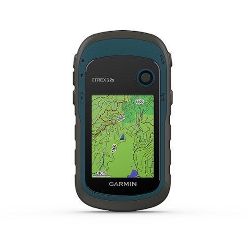
Price history for Garmin 010-02256-00 eTrex 22x, Rugged Handheld GPS Navigator, Black/Navy
Latest updates:
$171.00
- August 20, 2024
$177.97
- August 19, 2024
$172.59
- August 15, 2024
$170.89
- August 14, 2024
$177.97
- August 13, 2024
$173.00
- August 11, 2024
$173.78
- August 9, 2024
$179.10
- July 15, 2024
Since: July 15, 2024
Highest Price:
$179.10
- July 15, 2024
Lowest Price:
$170.89
- August 14, 2024
Last Amazon price update was: September 15, 2024 00:53
×
Product prices and availability are accurate as of the date/time indicated and are subject to change. Any price and availability information displayed on Amazon.com (Amazon.in, Amazon.co.uk, Amazon.de, etc) at the time of purchase will apply to the purchase of this product.
13 reviews for Garmin eTrex 22x Rugged Handheld GPS Navigator
4.5out of 5
★★★★★
★★★★★
10
★★★★★
1
★★★★★
1
★★★★★
0
★★★★★
1
Write a review
Show allMost HelpfulHighest RatingLowest Rating
★★★★★
josephstalin –
Bush walking
Helpful(0)Unhelpful(0)You have already voted this
★★★★★
George –
This is in general a very good product, but it is kind of difficult to use when zooming in/out and switching between features. It is also a bit of a pain to load routes onto it for trails. You have to have additional software and some website routes are not compatible with it. I had to spend a bunch of time dealing with tech support just to load my first trail route onto it. The screen is also difficult to see in the sun. That being said, when I was out on an unmarked, nearly invisible trail in the Mount St. Helens blast zone, this kept me in the right place.
Helpful(0)Unhelpful(0)You have already voted this
★★★★★
jbroham –
Arrived on time. Works well for hiking. A little cumbersome to access the pages, but I knew that going in. Great little GPS.
Helpful(0)Unhelpful(0)You have already voted this
★★★★★
Christine –
Love garmin products, however this gadget is a total waste of money. Can’t read anything on it , detail is too small to be of any help and trail following abilities just dismal. Bought this 2 months ago to bring to Sedona, AZ., to aid in hiking trails unknown to me and wife. just as a saftey net so to speak. Found it totally useless for anything other than general directions. No trail differentions, no directions at fork just a tiny arrow showing a general direction. Wish I had used it earlier. Tried it locally in NH and thought the local trails werent well known enough, in the white mountains, but didn’t matter, just as useless in Sedona on all trails. Even bought the special software maps for southwest from Garmin for $99.00 made no difference. My advice is to not waste your money on this toy. Either buy a much larger one and try it out first to see the “detail” of the maps or use your cell phone. Hiking place in Sedona told us to use Trek something free on phone app and uses satellite GPS. We had it on our phone after dismal performance of the Garmin etrex 22 and it was great. Had everything the Garmin was supposed to, with much greater detail, and free. Can’t return because my 30 days are up but don’t waste your money on this . Such a dissapointment as I have used Garmin products for over 12 years……but this thing is useless..
Helpful(0)Unhelpful(0)You have already voted this
★★★★★
New Hampshire Hiker –
Very nice , this is a replacement i needed , older version died , easy to use and lightweight , a must if you go off road as in hiking/camping/hunting or live in the mountains as i do .
Helpful(0)Unhelpful(0)You have already voted this
★★★★★
Aggie Noel –
My 13 year old son was going on a 10 mile hike with 3 of his friends in a place with no cell phone service, we got this as a primary GPS for him to use to make sure they didnt get lost as the trails are not clearly marked. We downloaded the GPX file for the trail and uploaded to the unit, he was able to follow it and mark way points along the trail. He was also using Gia Gps with the same GPX file on his phone when we got home we compared the data between the 2 devices and the data was very similar. The screen is small and the user interface is a bit dated but its basic and it works. For short hikes this is a good unit, if you need a backup for longer hikes or planning on being out for a few days this is a great secondary GPS.
Helpful(0)Unhelpful(0)You have already voted this
★★★★★
Nestor Segoviano –
Perfect! Exactly what we needed. Glad we purchased this unit and not a Chinese knock-off. This one is more expensive, but this is a well spent money. Most of the cost goes into a well honed software. The software is good. It performs as expected. At least for what we need. i.e: waypoints, tracks and area calculation. We use it as a track recording device and then we import the recordings and process them on a PC. We also prepare tracks on the PC, import them in the device and march them once in the field. The ability to see our current position relative to a programmed track is nice. The screen is a bit small for my aging eyes. This is not a product issue. We understand that something to be used during hiking must be small and light. Bigger is not better. Beside that a bigger screen would be very taxing on the batteries. We used the device for a few hours and the two AA alkaline batteries are still full. The color LCD screen is transflectif giving an excellent readability in full sun (which requires less back light which in turn requires less energy, hence more autonomy to the batteries). The manufacturer states an accuracy of 4 meters. When we stand still for an extended period of time, we can see our position randomly jumping around a point. Given enough time, it is possible to assume that the average position is quite accurate. For our needs, 4 meters is enough. Overall it is an excellent product. We did not test all functions.
Helpful(0)Unhelpful(0)You have already voted this
★★★★★
J. Lawler –
its done!
Helpful(0)Unhelpful(0)You have already voted this
★★★★★
david medina –
Excelente producto anteriormente en la oficina usaba estos gps, compacto y precisos al momento de realizar marcaciones o waypoints y trazado de mapas, super útiles para el trabajo de campo. 100 x 100 recomendable el producto así como el vendedor.
Helpful(0)Unhelpful(0)You have already voted this
★★★★★
Blackeagle –
This german device is very helpful for my profession. Because i am a land surveyor so so much easier to survey the land
Helpful(0)Unhelpful(0)You have already voted this
★★★★★
VIP –
4 stars because 5 would be perfect. NO NAVIGATION INSTRUMENT is 100% perfect 100% of the time. I have used this for a couple weeks walking and driving around town and hiking in The White Mountain National Forest. It DOES A GOOD JOB FOR THE MONEY! NEED TO KNOW. My unit would not work until updates were installed. The Open Source map is a GLOBAL (the entire planet) shaded relief map. That is a colossal amount of data. Plan on adding a micro SD card for extra memory, connecting to a computer and allowing LOTS of time for updates before using. After updating you may choose only the map regions you need to save memory. I like having the whole planet! Also, there is NO “lock safety” for the toggle and buttons. Be careful not to have them pressed while carrying the unit in a pouch or case. A little about me. I have been hiking/camping for over 50 years and never been “lost” for more than a short time (99.9% who say they never get disoriented occasionally either never goes out or lies). I could always get back to a known point in a reasonable time with map/compass, with both or only one (paper maps & magnetic compasses can be off too!). I do know how to get around in the woods. I do NOT backpack without paper map & magnetic compass. I have been using a handheld GPS for several years. They are good tools when properly used (always with paper map & magnetic compass). This Etrex 22x replaces my Garmin Oregon that was dropped & lost in a National Forest (Lesson learned, keep it tethered). In some ways I like the Etrex22x better. It has a nonslip side and fits my hand nicely. It is one hand usable (I think light weight gloves will be ok with it). The included Open Source map is more than adequate for basic navigation. This map is updated by users and in some places provides info only a user would be able to contribute. This map has some points paper maps do not have. You can add micro SD cards for specific maps. It’s helpful to compare information on several maps while backpacking. Etrex 22x has all the basic features/functions needed for general navigation. There is, of course, a learning curve. Garmin support is VERY HELPFUL. Be sure to use their expertise and learn the device BEFORE you go out. Some product info is confusing because the manual is for two GPS units (and, of course, some YouTubers are not correct). Etrex22x does NOT have a 3 axis compass or barometric altimeter. The compass only knows direction while moving (remember your magnetic compass!). The altimeter DOES know elevation from the satellite beacons. I have a barometric altimeter and have compared it to the etrex22x. I find the 22x more reliable. In TRACK MANAGER and ROUTE PLANNER you will find an elevation plot. Etrex 22x CAN BE used for automotive navigation. It WILL relocate route on roadways. It can also plan routes for bicycle and pedestrian. You must select mode of travel. Etrex 22x Open Source map DOES have some boundaries for state and federal lands. These boundaries are not as detailed as what is provided with micro SD cards, but do give the general area. Open Source maps are updated as new info becomes available. Check for updates every once-in-awhile. Overall, I am confident that the etrex 22x will track my hike and give me the info I need to navigate The White Mountain National Forest and Wilderness areas (some impressively varied terrain!), on and off trails (again, along with a magnetic compass and paper map). This replaces a much more expensive GPS unit that had a map specific card installed. It was a tough act to follow. It does well. For the money, I am impressed.
This GPS navigator is packed full of features. It offers a plethora of modes to mark waypoints. The screen is sharp and clear. Its screen lighting is sufficient enough to view the screen in sunlight. The ability to interface with the unit via bluetooth was one of the deciding factors that made me choose to go with the 22x model. Overall, the GPS unit is well made, compact in design, and offers more than enough features to cover all of the things I will use it for.
Helpful(0)Unhelpful(0)You have already voted this
Only logged in customers who have purchased this product may leave a review.


josephstalin –
Bush walking
George –
This is in general a very good product, but it is kind of difficult to use when zooming in/out and switching between features. It is also a bit of a pain to load routes onto it for trails. You have to have additional software and some website routes are not compatible with it. I had to spend a bunch of time dealing with tech support just to load my first trail route onto it. The screen is also difficult to see in the sun. That being said, when I was out on an unmarked, nearly invisible trail in the Mount St. Helens blast zone, this kept me in the right place.
jbroham –
Arrived on time. Works well for hiking. A little cumbersome to access the pages, but I knew that going in. Great little GPS.
Christine –
Love garmin products, however this gadget is a total waste of money. Can’t read anything on it , detail is too small to be of any help and trail following abilities just dismal. Bought this 2 months ago to bring to Sedona, AZ., to aid in hiking trails unknown to me and wife. just as a saftey net so to speak. Found it totally useless for anything other than general directions. No trail differentions, no directions at fork just a tiny arrow showing a general direction. Wish I had used it earlier. Tried it locally in NH and thought the local trails werent well known enough, in the white mountains, but didn’t matter, just as useless in Sedona on all trails. Even bought the special software maps for southwest from Garmin for $99.00 made no difference. My advice is to not waste your money on this toy. Either buy a much larger one and try it out first to see the “detail” of the maps or use your cell phone. Hiking place in Sedona told us to use Trek something free on phone app and uses satellite GPS. We had it on our phone after dismal performance of the Garmin etrex 22 and it was great. Had everything the Garmin was supposed to, with much greater detail, and free. Can’t return because my 30 days are up but don’t waste your money on this . Such a dissapointment as I have used Garmin products for over 12 years……but this thing is useless..
New Hampshire Hiker –
Very nice , this is a replacement i needed , older version died , easy to use and lightweight , a must if you go off road as in hiking/camping/hunting or live in the mountains as i do .
Aggie Noel –
My 13 year old son was going on a 10 mile hike with 3 of his friends in a place with no cell phone service, we got this as a primary GPS for him to use to make sure they didnt get lost as the trails are not clearly marked. We downloaded the GPX file for the trail and uploaded to the unit, he was able to follow it and mark way points along the trail. He was also using Gia Gps with the same GPX file on his phone when we got home we compared the data between the 2 devices and the data was very similar. The screen is small and the user interface is a bit dated but its basic and it works. For short hikes this is a good unit, if you need a backup for longer hikes or planning on being out for a few days this is a great secondary GPS.
Nestor Segoviano –
Perfect! Exactly what we needed. Glad we purchased this unit and not a Chinese knock-off. This one is more expensive, but this is a well spent money. Most of the cost goes into a well honed software.
The software is good. It performs as expected. At least for what we need. i.e: waypoints, tracks and area calculation.
We use it as a track recording device and then we import the recordings and process them on a PC. We also prepare tracks on the PC, import them in the device and march them once in the field. The ability to see our current position relative to a programmed track is nice. The screen is a bit small for my aging eyes. This is not a product issue. We understand that something to be used during hiking must be small and light. Bigger is not better. Beside that a bigger screen would be very taxing on the batteries.
We used the device for a few hours and the two AA alkaline batteries are still full.
The color LCD screen is transflectif giving an excellent readability in full sun (which requires less back light which in turn requires less energy, hence more autonomy to the batteries).
The manufacturer states an accuracy of 4 meters. When we stand still for an extended period of time, we can see our position randomly jumping around a point. Given enough time, it is possible to assume that the average position is quite accurate. For our needs, 4 meters is enough.
Overall it is an excellent product. We did not test all functions.
J. Lawler –
its done!
david medina –
Excelente producto anteriormente en la oficina usaba estos gps, compacto y precisos al momento de realizar marcaciones o waypoints y trazado de mapas, super útiles para el trabajo de campo. 100 x 100 recomendable el producto así como el vendedor.
Blackeagle –
This german device is very helpful for my profession. Because i am a land surveyor so so much easier to survey the land
VIP –
4 stars because 5 would be perfect. NO NAVIGATION INSTRUMENT is 100% perfect 100% of the time.
I have used this for a couple weeks walking and driving around town and hiking in The White Mountain National Forest. It DOES A GOOD JOB FOR THE MONEY!
NEED TO KNOW. My unit would not work until updates were installed. The Open Source map is a GLOBAL (the entire planet) shaded relief map. That is a colossal amount of data. Plan on adding a micro SD card for extra memory, connecting to a computer and allowing LOTS of time for updates before using. After updating you may choose only the map regions you need to save memory. I like having the whole planet! Also, there is NO “lock safety” for the toggle and buttons. Be careful not to have them pressed while carrying the unit in a pouch or case.
A little about me. I have been hiking/camping for over 50 years and never been “lost” for more than a short time (99.9% who say they never get disoriented occasionally either never goes out or lies). I could always get back to a known point in a reasonable time with map/compass, with both or only one (paper maps & magnetic compasses can be off too!). I do know how to get around in the woods. I do NOT backpack without paper map & magnetic compass.
I have been using a handheld GPS for several years. They are good tools when properly used (always with paper map & magnetic compass). This Etrex 22x replaces my Garmin Oregon that was dropped & lost in a National Forest (Lesson learned, keep it tethered).
In some ways I like the Etrex22x better.
It has a nonslip side and fits my hand nicely. It is one hand usable (I think light weight gloves will be ok with it). The included Open Source map is more than adequate for basic navigation. This map is updated by users and in some places provides info only a user would be able to contribute. This map has some points paper maps do not have. You can add micro SD cards for specific maps. It’s helpful to compare information on several maps while backpacking.
Etrex 22x has all the basic features/functions needed for general navigation.
There is, of course, a learning curve. Garmin support is VERY HELPFUL. Be sure to use their expertise and learn the device BEFORE you go out.
Some product info is confusing because the manual is for two GPS units (and, of course, some YouTubers are not correct).
Etrex22x does NOT have a 3 axis compass or barometric altimeter. The compass only knows direction while moving (remember your magnetic compass!). The altimeter DOES know elevation from the satellite beacons. I have a barometric altimeter and have compared it to the etrex22x. I find the 22x more reliable. In TRACK MANAGER and ROUTE PLANNER you will find an elevation plot.
Etrex 22x CAN BE used for automotive navigation. It WILL relocate route on roadways. It can also plan routes for bicycle and pedestrian. You must select mode of travel.
Etrex 22x Open Source map DOES have some boundaries for state and federal lands. These boundaries are not as detailed as what is provided with micro SD cards, but do give the general area. Open Source maps are updated as new info becomes available. Check for updates every once-in-awhile.
Overall, I am confident that the etrex 22x will track my hike and give me the info I need to navigate The White Mountain National Forest and Wilderness areas (some impressively varied terrain!), on and off trails (again, along with a magnetic compass and paper map). This replaces a much more expensive GPS unit that had a map specific card installed. It was a tough act to follow. It does well. For the money, I am impressed.
josephstalin –
日本語の説明書や本体の表示が全く理解出来なく、返信して何か騙されてお金を取られた気持ちですね。凄く残念です。
VIP –
This GPS navigator is packed full of features. It offers a plethora of modes to mark waypoints. The screen is sharp and clear. Its screen lighting is sufficient enough to view the screen in sunlight. The ability to interface with the unit via bluetooth was one of the deciding factors that made me choose to go with the 22x model. Overall, the GPS unit is well made, compact in design, and offers more than enough features to cover all of the things I will use it for.